Barracks Rd, Lewis Mt, the Meadows
LewisMeadowsBarracks (click PDF)
Spring 2013
Team members: Olivia Dillingham, Payton May, Jaline Mcpherson, Christine Nguyen, Margaret Wyatt
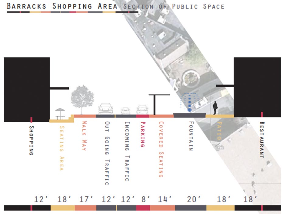
Our objective in this project was to analyze three neighborhoods –Barracks Road, Lewis Mountain, and the Meadows, and to figure out what works in these areas in terms of walkability and accessibility to basic necessities. We looked at roads and parking areas, sidewalks and walking areas, tree coverage and green space, various methods of transportation (car, bus, bike, foot), and building types within each neighborhood. Our main goal was to figure out how people operate within these spaces: Do they walk within the neighborhoods? Do they drive everywhere? Is there some gathering place within each of these neighborhoods? Do people use bus lines that run through their neighborhoods? Why or why not?
In order to analyze the ways in which people inhabit these neighborhoods, we have gathered data in several different formats. We chose to focus on sections within each neighborhood that we felt accurately represented the areas as a whole. We have gathered maps of each of these smaller sections within the larger neighborhoods, and have gathered data on each of these sections that highlight walkability and transportation.